
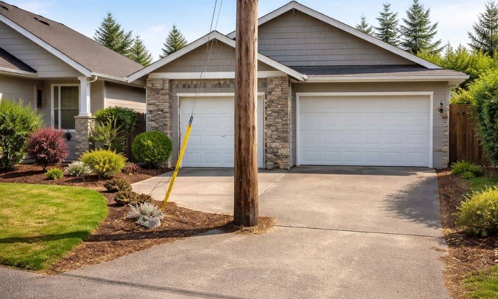
A home can look perfect online. The driveway looks wide. The front yard feels open. Everything seems easy to use. Then you show up in person. A pole blocks part of the driveway. The entry feels tighter than expected. Or the space you thought you could use is not really yours. This happens more often than people think. Photos show what looks good. They don’t show how the property actually works. That gap is where surveying companies come in.
The Problem That Doesn’t Show in Photos
Access sounds simple. You assume you can drive in, park, and move around without issues. But access is not just about space. It’s about what you are allowed to use.
Some properties have limits that are easy to miss at first glance.
A driveway might cross into a shared area. An entry path might sit on land that has rules attached to it. Utility poles or boxes might take up space you thought was usable.
So even if the property looks open, your actual use may be limited.
That’s the kind of problem photos rarely reveal.
Why Listing Photos Can Be Misleading
Photos are meant to attract attention. They focus on angles that make a property look clean and open.
What they leave out are the details that affect daily use.
You won’t see exact property lines in a photo. You won’t see where access starts or ends. You won’t see if part of the space belongs to someone else or falls under a restriction.
A driveway can look like it belongs to the home. In reality, part of it could be shared or restricted.
That difference matters once you move in or start making plans.
How Surveying Companies See What Buyers Miss
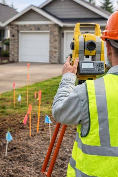
This is where surveying companies make a real difference.
They don’t rely on what a property looks like in photos. Instead, they focus on how the land actually works in real life.
They check where the true entry points are. They look at how access lines up with property lines. They also compare official records with what’s on the ground.
A lot of this comes out during a site survey, when everything gets looked at up close.
So instead of guessing, you get a clear picture of what you can actually use. That clarity helps you avoid surprises later.
When Access Issues Turn Into Real Problems
Most buyers don’t think about access until something goes wrong.
A driveway may not fully belong to the property. That limits parking. It can also create tension with neighbors.
Someone may plan to build or expand. Then they find out the entry space does not allow it.
Another buyer may assume they can bring in equipment or make changes. Later, they learn the usable entry is too narrow or restricted.
These situations don’t come from bad luck. They come from missing details early.
Why This Happens More in Las Vegas
Las Vegas keeps growing. New homes go up next to older properties. Land gets divided and reused.
That mix can create confusion.
Older layouts may not match how people want to use the land today. Shared access points become more common. Space between structures gets tighter.
So a property may look simple online. In person, it has limits that affect how you use it.
Surveying companies in Las Vegas deal with these situations often. They know where problems tend to show up.
When to Bring in Surveying Companies
Timing plays a big role.
If you wait too long, you may already be committed. That makes changes harder and more expensive.
It makes more sense to involve surveying companies early. Before you finalize a deal. Before you make plans for the space.
Pay close attention when something feels tight or unclear. That small doubt is usually a sign to take a closer look.
The Cost of Overlooking Access
Access issues don’t stay small.
They can delay a closing. They can force changes to your plans. They can limit how you use the property.
In some cases, they reduce the value of what you bought.
That is frustrating, especially when the property looks fine at first.
Why This Step Matters More Than It Seems
Photos help you decide if you like a property. They don’t tell you if the property works the way you expect.
Access is one of those details that hides in plain sight.
Surveying companies help bring that detail into the open. They show you what is usable, what is shared, and what may cause problems later.
That kind of clarity makes a big difference.
Before trusting what you see online, it helps to understand what is actually there.