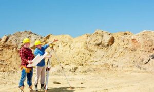
In places like Pahrump, wide-open land makes drone land surveying a powerful tool for mapping and measuring property. Developers, builders, and property owners count on drones because they deliver speed and precision. But what happens when the satellites that guide those drones stop working the way they should?
That concern turned real in late September. U.S. aviation authorities raised alarms about GPS “jamming” and “spoofing,” while Europe’s Galileo system carried out a planned satellite outage from September 24–26. For surveyors, where accuracy often comes down to a single inch, these disruptions highlight how fragile satellite signals can be. The good news is that skilled survey crews know how to keep projects on track—even when satellites wobble.
Why Satellites Matter So Much
Every modern survey-grade drone depends on satellite positioning. Systems like GPS, Galileo, and GLONASS work together to pinpoint a drone’s location within a fraction of an inch. That accuracy is what makes drone surveys useful for property line checks, construction staking, and ALTA land title surveys.
The problem? Satellite signals are fragile. They travel thousands of miles from space and can be disrupted by interference on the ground. Jamming happens when a device blocks the signal. Spoofing is worse—it tricks receivers with false signals. Add planned outages like the Galileo downtime this week, and surveyors can suddenly lose the tight precision they rely on.
For a place like Pahrump, where large desert parcels leave little room for error, even a short satellite glitch can cause big setbacks.
How Signal Problems Affect Projects
Imagine a subdivision plan where every boundary needs to be within an inch to pass review. If satellites drift, a line may show up two or three inches off. That tiny slip could force a redraw, delaying permits or closings.
The same risk applies to construction. A staking survey that sets out foundation corners can’t afford to be off by more than a fraction of a foot. If a concrete pad gets poured on the wrong line, fixing it later becomes costly.
Even mortgage closings can feel the impact. Lenders require accurate surveys before funding a loan. A shaky satellite reading could delay the paperwork, pushing back a buyer’s move-in date.
Why Drone Land Surveying Isn’t the Problem
It’s important to understand that drones themselves are not the weak link. The issue lies in the invisible signals they depend on. A professional surveyor never sends a drone into the air without a plan for quality control.
In fact, drones often improve resilience. They collect thousands of points in minutes, and surveyors can cross-check that data against ground control markers. With smart workflows, drones become part of the solution, not part of the problem.
The Playbook for Accuracy When Satellites Fail

So, how do surveyors keep projects on target when satellites go shaky? The answer is a mix of technology, timing, and communication.
First, they watch constellation health updates. When the Galileo outage was announced, surveyors checked schedules and avoided flying during the worst windows. That alone prevents many errors.
Next, they set up local base stations. A base collects data on the ground, then corrects the drone’s readings. Short baselines between drone and base help remove errors caused by satellite drift.
Surveyors also record static control points. These fixed markers serve as reality checks. If a drone’s map doesn’t match the static log, the team knows something is off and can correct it before delivering results.
Finally, crews adjust their timelines. If a critical ALTA survey is due, they might shift the flight by a day or two to work outside an outage. For clients, that small delay protects against expensive mistakes later.
What Clients Need to Hear
From a property owner’s perspective, it can feel frustrating when a surveyor says, “We need to wait until tomorrow to fly.” But that short wait is actually a safeguard.
Think of it like checking the weather before pouring concrete. If rain is forecast, you wait a day to avoid cracks. The same logic applies to satellites. Surveyors aren’t making excuses—they’re protecting accuracy, liability, and your investment.
Clear communication is key. Good surveyors explain the issue in plain English: “The satellites that guide our drone are unstable today. We’ll reschedule tomorrow so your boundary lines are exact. That way, your closing won’t face surprises.”
For clients, this transparency builds trust. Instead of worrying about delays, they see a professional team making careful choices.
Why It Matters
Pahrump is unique. Its desert landscape means properties often stretch over dozens of acres. Unlike city lots, rural boundaries here can run thousands of feet. That scale amplifies any measurement error.
Drone land surveying shines in these conditions. It covers ground quickly, reaches remote corners, and delivers maps that traditional crews would spend days creating. But the reliance on satellites is higher too, which makes resilience strategies essential.
For local developers, homeowners, and lenders, knowing that surveyors have a backup plan offers peace of mind. Projects stay on budget, closings stay on track, and construction can move forward without costly rework.
The Bottom Line
Satellite outages and interference aren’t rare events anymore. They happen often enough that professional surveyors treat them like summer thunderstorms—predictable, manageable, but never to be ignored.
The takeaway is simple: even when satellites fail, licensed land surveyors have the tools and training to deliver accurate results. Drones, base stations, static control points, and smart scheduling all work together to keep precision high.
For anyone planning a subdivision, building project, or property purchase, the lesson is clear: trust drone land surveying, but only in the hands of experienced surveyors who know how to handle the unexpected.
