Even a small shake can make a big difference when it comes to land. After the recent Nevada earthquake near Tonopah, many homeowners and property investors started wondering if they should check their property boundaries. It’s a fair question—because while earthquakes might not rewrite legal documents, they can shift the markers and measurements that define your land. That’s where an ALTA Land Title Survey comes in. It’s one of the most detailed surveys you can order, and in places like Pahrump—where the ground is soft, and tremors aren’t uncommon—it’s an investment that keeps your property records accurate and defensible.
When the Ground Moves, Boundaries Don’t—But Markers Might
Nevada has a reputation for its dry beauty and wide-open land, but it’s also the third most seismically active state in the U.S., after California and Alaska. The magnitude 3.6 quake recorded near Tonopah on November 1, 2025, wasn’t strong enough to cause major damage, but it did get people’s attention across Nye County.
Here’s what’s important to understand: property boundaries don’t physically move after a quake. Your legal ownership is recorded in your deed, and that doesn’t change. However, the monuments, pins, and markers that identify your property corners can shift. A small movement in the soil, especially in Pahrump’s sandy, alluvial terrain, can make those markers unreliable.
If your fence suddenly looks off, or you notice cracks near your boundary walls, the land itself may have settled or shifted. It’s not that your property line has changed—it’s that the evidence of where it’s located might now be in question.
Why Soil Makes Things Tricky
Pahrump sits in a valley made of soft, water-laid sediments. That’s good for growing gardens but not ideal when the ground starts shaking. This kind of soil can act like jelly during a quake—it moves and settles unevenly. Over time, that creates minor differences in elevation and slope.
Older subdivisions, especially those built before modern grading standards, often experience differential settlement—one side of a lot might sink slightly more than the other. When you add seismic movement to that mix, small misalignments can appear in fences, driveways, or retaining walls.
For most homeowners, these changes are cosmetic. But if you’re planning to sell, refinance, or build, even minor shifts can complicate things. That’s when an ALTA Land Title Survey becomes more than a formality—it becomes proof of your land’s exact, post-event condition.
What Makes an ALTA Land Title Survey Different
Unlike a basic boundary survey, an ALTA survey doesn’t just show where your land begins and ends. It maps every visible and recorded detail that affects ownership—easements, access roads, utility lines, encroachments, and more. Lenders and title companies rely on it because it meets strict national standards from the American Land Title Association (ALTA) and the National Society of Professional Surveyors (NSPS).
After an earthquake or any significant ground movement, ordering a new ALTA survey helps confirm that everything still matches your title records. It also provides an updated legal snapshot if:
- You’re refinancing or transferring ownership.
- Your lender asks for updated survey documentation.
- You plan new construction or expansion.
- You’ve noticed visible ground or structure changes.
Think of it like getting a health checkup for your property—especially when the ground beneath it just got a wake-up call.
How a Quake Can Affect Survey Markers and Elevations

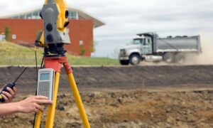
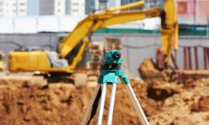
Let’s get practical. When a quake hits, the ground vibrates and can slightly shift horizontally or vertically. It’s often too subtle for the naked eye, but survey-grade equipment can detect even a few centimeters of difference.
Here’s what might happen:
- Monuments Move: Iron pins or concrete corners may tilt or settle deeper into the soil.
- Benchmarks Shift: If elevation points move, they can throw off drainage and flood calculations.
- Fences Drift: In loose soil, posts can lean or twist, creating the illusion that your neighbor’s yard “moved.”
If these shifts aren’t checked, future surveys might show discrepancies that confuse title insurers or county assessors. Updating your ALTA Land Title Survey ensures everyone—from lenders to buyers—works from the same, accurate baseline.
Why It Matters More in Flood-Prone Areas
Pahrump isn’t just about earthquakes—it’s also about flooding. Parts of Nye County fall within FEMA’s mapped floodplains, and small changes in ground level can affect flood risk ratings. If the soil has settled since your last survey, your elevation benchmarks might be slightly off. That means your flood elevation certificate could be outdated, even if the structure itself hasn’t changed.
Pairing an updated ALTA Land Title Survey with a new elevation survey gives you a full picture: the legal boundaries, plus the true elevations that matter for flood insurance and construction planning.
What You Can Do After a Quake
You don’t need to panic after every tremor, but it’s smart to stay observant. After an earthquake, walk your property and look for:
- Missing or buried boundary markers.
- Cracked driveways or patios near property edges.
- Leaning fences or retaining walls.
- Drainage patterns that suddenly changed after rain.
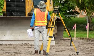
If something feels off, call a licensed land surveyor—don’t try to dig up or move markers yourself. The surveyor can check the original control points and confirm whether anything has actually shifted. If needed, they’ll recommend updating your ALTA Land Title Survey to reflect the current site conditions.
Why Local Experience Matters
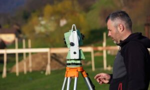
Nevada’s terrain isn’t uniform, and Pahrump’s mix of desert plains and gentle slopes requires a surveyor who knows the local geology. A licensed land surveyor familiar with Nye County understands how to compare your property’s monuments to nearby control points in the National Spatial Reference System.
That kind of verification isn’t just technical—it protects you from future disputes. A small shift today might become a big question during your next real estate deal, especially if a lender requests updated documents.
Stability Starts with Verification
Earthquakes don’t just shake the ground; they shake confidence. And in property matters, confidence comes from clarity. A professional ALTA Land Title Survey gives you that peace of mind—showing your boundaries, improvements, and easements exactly as they exist today.
For property owners, it’s not about fear—it’s about staying proactive. The land may settle, but your records shouldn’t. After all, stability starts with verification.
