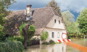
When the late September floods hit Laughlin, the community saw just how quickly the Colorado River can change the landscape. Streets were underwater, fences collapsed, and homeowners rushed to clean up debris. In the middle of that chaos, one detail often gets overlooked: property boundaries. A boundary line survey may not sound urgent, but after a flood it becomes one of the most important steps before repairing or rebuilding your property.
Floods Don’t Just Damage Homes — They Shift Boundaries
Flash floods don’t only wash out roads and fill basements. They also move the very markers that define your property lines. Survey monuments, pins, or stakes buried underground can be displaced, hidden, or eroded. Even a small shift creates uncertainty about where your yard ends and your neighbor’s begins.
Think about fences, driveways, or walls. If water undermines the soil beneath them, those features may not stand where they once did. Rebuilding without checking the actual lines can spark boundary disputes later. And when emotions are already high after a natural disaster, the last thing anyone wants is an argument with the neighbor.
Why a Boundary Line Survey Protects You After Flooding
A flood changes the physical landscape in ways you may not notice at first glance. Ordering a boundary line survey after a flood gives you more than a map. It gives you peace of mind.
Here’s why it matters:
- Protect your repairs. If you’re putting up a new fence or replacing a wall, a survey makes sure you build in the right place. After a storm, the ground often shifts, which is why many homeowners schedule survey services for post-flood repairs before letting contractors start work.
- Keeps insurance claims strong. Insurers and FEMA rely on accurate property data. A recent survey can support your case if you need reimbursement.
- Prevents future disputes. You’ll have proof of where your land begins and ends, which avoids costly disagreements with neighbors.
- Keeps you legal. In Nevada, it’s against the law to disturb or move a survey monument on your own. A licensed surveyor can recover and document corners correctly.
The Colorado River Corridor Brings Extra Risk
Laughlin sits on the edge of the Colorado River, which makes life beautiful but also unpredictable. When the river rises quickly, water can carve new drainage paths through neighborhoods. Soil shifts, retaining walls collapse, and hidden survey markers may be covered in sediment.
The National Weather Service specifically issued flash flood alerts for Laughlin during the September storms. Viral clips showed parking lots turning into rivers. Those same rushing waters can wash away the small iron rods that surveyors rely on to mark your property corners. If you repair without verifying those points, you could end up building on the wrong side of the line.
What a Survey Looks Like After a Flood

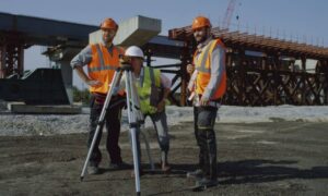
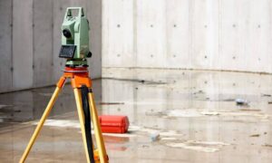
Some homeowners imagine a survey as a piece of paper with measurements, but in reality it’s much more hands-on. After a flood, a surveyor heads to your property with specialized equipment. They’ll use GPS, total stations, and local benchmarks to find where your property lines should be. If markers are missing, they can reset them according to county records.
In many cases, surveyors also provide updated maps that show changes to the land. If floodwaters carved a deeper slope or shifted a drainage channel, a topographic layer may be added. This detail helps both insurance companies and contractors understand the new conditions before they begin work.
Real-Life Impact: From Disputes to Delays
Consider a simple example. A Laughlin homeowner starts replacing a fence washed away by the storm. Without a survey, the contractor sets new posts where the old ones stood. Months later, the neighbor realizes the fence is actually two feet inside their lot. Now both owners are frustrated, and what could have been solved with a survey turns into a costly legal problem.
Or picture a driveway repair. Floods weaken the soil under concrete, making it unsafe. Before pouring new concrete, a survey confirms the drive actually sits on your property and not partly on a neighbor’s. In fast-growing river towns like Laughlin, where lots can be irregular, this step avoids expensive mistakes.
Beyond Boundaries: Elevation Matters Too
Floods often raise another issue: elevation. If water reached your foundation, your flood risk profile may have changed. Many lenders and insurance providers require a current Elevation Certificate to confirm whether your home is above or below the base flood elevation.
While a boundary line survey tells you where your land ends, an elevation survey tells you how high your home sits compared to flood levels. Together, these documents form a complete picture of your property’s safety and compliance.
Moving Forward With Confidence
The urge to rebuild quickly after a disaster is strong. But rushing into repairs without first confirming your property boundaries can create bigger problems than the flood itself. A boundary line survey gives you confidence that every dollar you spend on repairs is invested on land that’s truly yours.
Laughlin homeowners have already been through enough stress this season. By bringing in a licensed land surveyor before hiring contractors, you protect your property, your wallet, and your peace of mind.
Final Thoughts
Floodwaters may disappear in days, but the damage they leave behind lasts much longer. Soil shifts, boundaries blur, and property lines become uncertain. If you’re planning post-flood repairs, don’t skip the step that safeguards everything else: the boundary line survey.


